Daily activity:
Thursday 22nd.: water temp57.6 ESE 8-12mph in the a.m. / 60.1 SE 3-6mph in the p.m. The water was crystal clear. The bite was very slow. There was a Palmetto and a small Flounder caught. There were a few Squid caught last night.
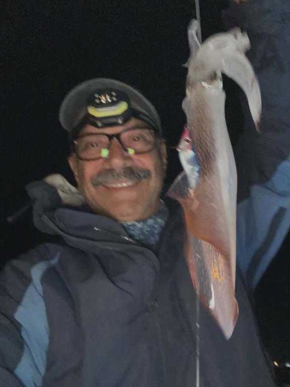
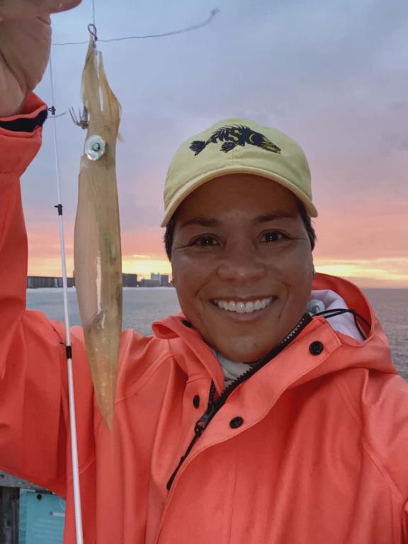
Friday: water temp 60.4 ENE 8-12mph in the a.m. / 61.2 SSE 1-5mph in the p.m. The water was crystal clear. Brenda got a few Squid at sunrise. Steve L. got a nice Flounder in the morning and there was a Bluefish caught in the afternoon.
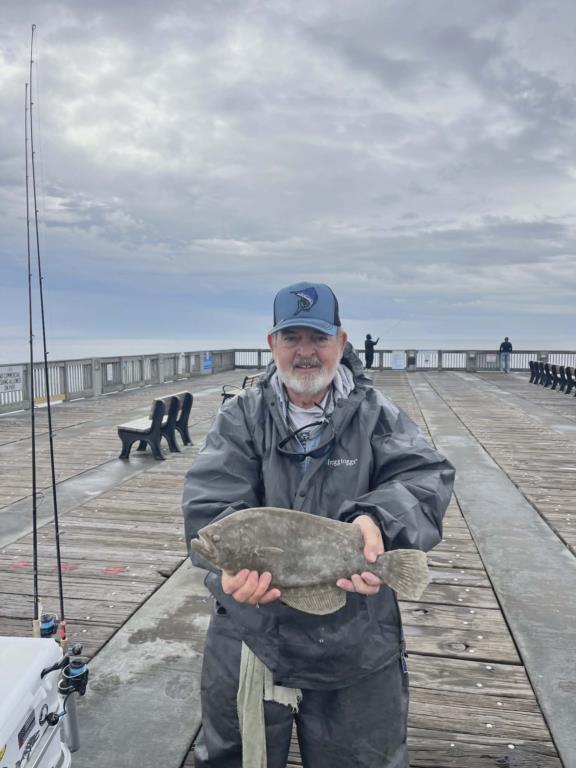
Saturday: water temp 60.8 NE 8-13mph in the a.m. / 61.5 SE 9-13mph in the p.m. The water was clean. A few Flounder were caught.
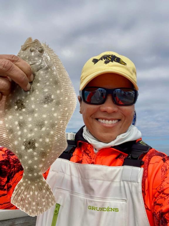
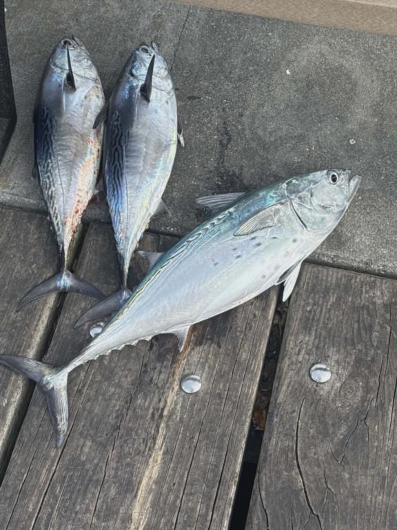
Sunday: water temp water temp 61.7 SE 20-25mph in the a.m. / 6?.5 SE 9-13mph in the p.m. The water was clean. A few Bluefish and a Flounder were caught in the morning. A few Bonito came in midafternoon like these Hachid decked.
Monday: water temp 60.6 NNW 12-20mph in the a.m. / 59.7 NNW 14-20mph by noon / 59.0 N 15-25 in the p.m. The water was clean. The conditions were poor as the pier remained a ghost town. Too cold to fish.
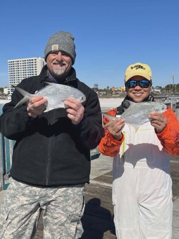
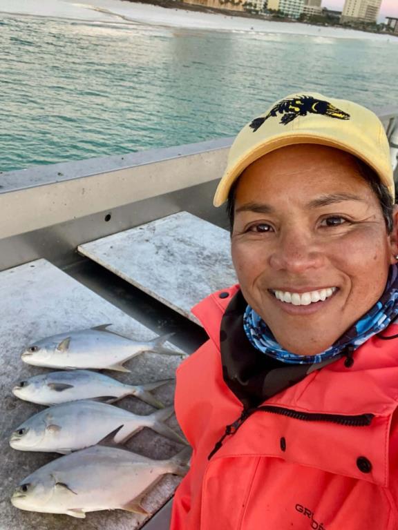
Tuesday: water temp 57.4 N 7-12mph in the a.m. / 55.0 at 09:50 / 58.8 N 5-10mph in the p.m. The water was clean. There were Pompano and Bluefish in the afternoon.
Wednesday 28th.: water temp 55.2 N 3-6mph in the a.m. / by 08:00 it had dropped to 54.9 / then managed 56.8 W 10-13mph by 5:00 p.m. No catch reports.
Red Tide status: In Northwest Florida over the past week, K. brevis was not observed.
Tides Link
https://tides4fishing.com/us/florida-west-coast/panama-cityngin g
Full Moon Sunday Feb. 01, 2026 - Full Moon Tuesday Feb. 17, 2026 -
Tides for the upcoming week:
Sunrise: 6:34am Sunset: 5:17pm
Friday 5:56am Low -1.1 7:49pm High 1.4
Saturday 6:45am Low -1.0 8:51pm High 1.4
Sunday 7:30am Low -0.9 9:51pm High 1.2
Monday 8:06am Low -0.7 10:46pm High 1.0
Tuesday 8:25am Low -0.4 11:39pm High 0.8
Wednesday 04th. 7:52am Low -0.2
Sunrise: 6:30am Sunset: 5:22pm CST
The Marine forecast for the next several days is:
FRIDAY
Southeast winds around 10 knots, becoming west in the afternoon. Waves 1 foot or less. Wave Detail: Southwest 2 feet at 3 seconds and southeast 1 foot at 3 seconds. Protected waters a moderate chop. A chance of showers in the morning, then showers likely in the afternoon.
FRIDAY NIGHT
Northwest winds 15 to 20 knots, becoming north 25 to 30 knots after midnight. Seas around 3 feet, building to 4 to 6 feet, occasionally to 8 feet after midnight. Wave Detail: Northwest 3 feet at 4 seconds, becoming northwest 5 feet at 5 seconds. Protected waters very rough. A chance of showers.
SATURDAY
Northwest winds 25 to 30 knots, increasing to 30 to 35 knots in the afternoon. Seas 6 to 9 feet, occasionally to 11 feet, building to 8 to 11 feet, occasionally to 14 feet in the afternoon. Protected waters extremely rough. A chance of showers.
SATURDAY NIGHT
Northwest winds 30 to 35 knots, becoming north 25 to 30 knots after midnight. Seas 9 to 13 feet, occasionally to 17 feet, subsiding to 8 to 11 feet, occasionally to 14 feet after midnight. Protected waters extremely rough. A slight chance of rain and snow showers.
SUNDAY
North winds 25 to 30 knots, becoming northwest 20 to 25 knots in the afternoon. Seas 6 to 9 feet, occasionally to 11 feet, subsiding to 5 to 7 feet, occasionally to 9 feet in the afternoon. Protected waters very rough.
SUNDAY NIGHT
Northwest winds 15 to 20 knots. Seas 3 to 5 feet, occasionally to 6 feet. Protected waters choppy.
(local forecast).
FRIDAY (62/34 rain 15% wind SSE-5-10 in am / NNW 10-20 in pm)
SATURDAY (39/24 rain 03% wind NNW-20-30 in am / NNW 15-25 in pm)
SUNDAY (44/31 rain 01% wind NNW-10-20 in am / NNW 5-10 in pm)
MONDAY (51/37 rain 01% wind NW-5-10 in am / Light and variable in pm)
TUESDAY (56/43 rain 03% wind ESE-5-10 in am / ESE 5-10 in pm)
WEDNESDAY(61/46 rain 17% wind SSE-10-15 in am / NNW 10-15 in pm)
PIER MANAGEMENT CONTACT INFORMATION:
Bay County Parks and Recreation – 5304 Majetti Tower Road Panama City, FL 32404
850-248-8730
Vince Martin – Bay Co. Parks Division Manager - vmartin@baycountyfl.gov - 850-896-6580
Timothy Pentice- Bay Co. Asst. Div. Mgr. – tprentice@baycountyfl.gov – 448-217-4219
Tight lines and screaming drags,
Sam
SLP053@BELLSOUTH.NET
770-265-2879